Detection Analyzer - Internal tool for geospatial data correctness validation
An internal web application for validating the correctness of machine learning detected geospatial data by visualizing it on maps and comparing it with ground truth data from multiple sources.
- Year
- 2024
- Role
- Lead Software Engineer
- Duration
- 3 months
Gallery
Overview
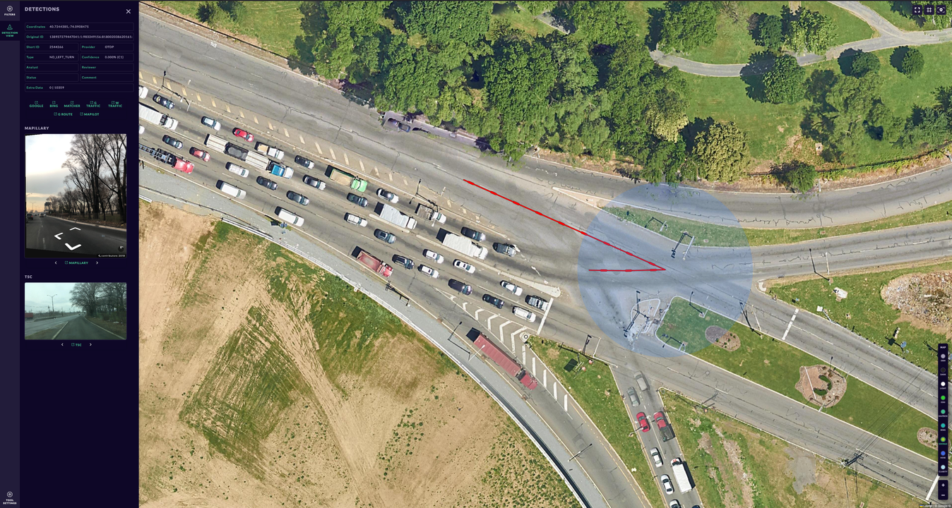
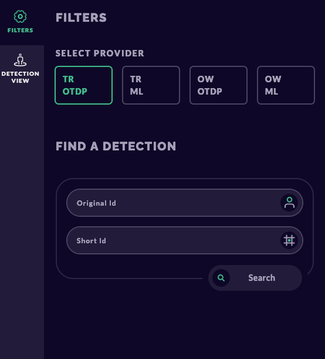
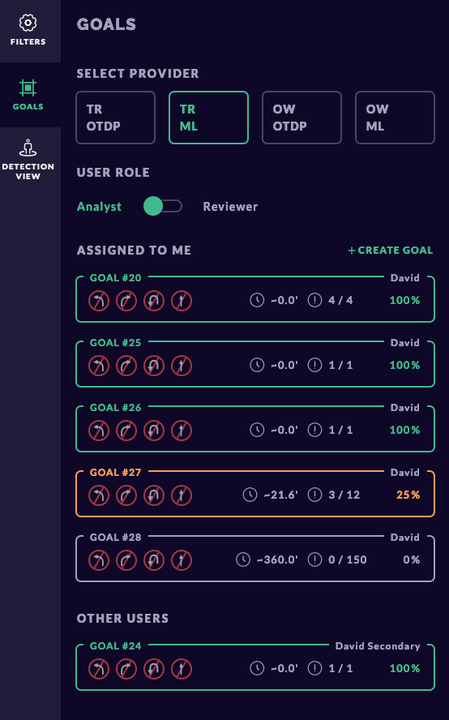
The analists needed a tool to validate the correctness of ML detected geospatial data before being used in production systems. The application allows users to visualize detection data on maps, compare it with ground truth data from multiple sources, and perform various analyses to identify discrepancies and improve detection accuracy. The analists had to review eachother's work and validate the corrections made to ensure high-quality results. Once validated, the corrected data is processed and exported through Golang gRPC for further use in production systems.
Key Features
- Geospatial Data Visualization: Interactive maps to visualize detection data points and paths.
- Ground Truth Comparison: Overlay and compare detected data with ground truth from multiple sources.
- Discrepancy Analysis: Tools to identify and analyze discrepancies between detected and ground truth data.
- User Review and Validation: Functionality for analysts to review each other's work and validate corrections.
- gRPC Data Export: Seamless export of validated data through Golang gRPC for further processing.
Technologies Used
Challenges & Solutions
Ensuring accurate visualization and comparison of large geospatial datasets. Implementing user review and validation workflows to maintain high data quality. Integrating gRPC communication for efficient data export and processing.
Interested in working together?
Let's discuss your next project and how I can help bring it to life.