GeoRoute Viewer - A full-stack application for visualizing large-scale geospatial data
GeoRoute Viewer is a full-stack application designed to efficiently render and display large-scale geospatial route data on maps for analysis and insights.
- Year
- 2022
- Role
- Lead Software Engineer
- Duration
- 4 months
Gallery
Overview
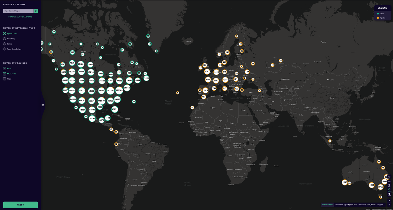
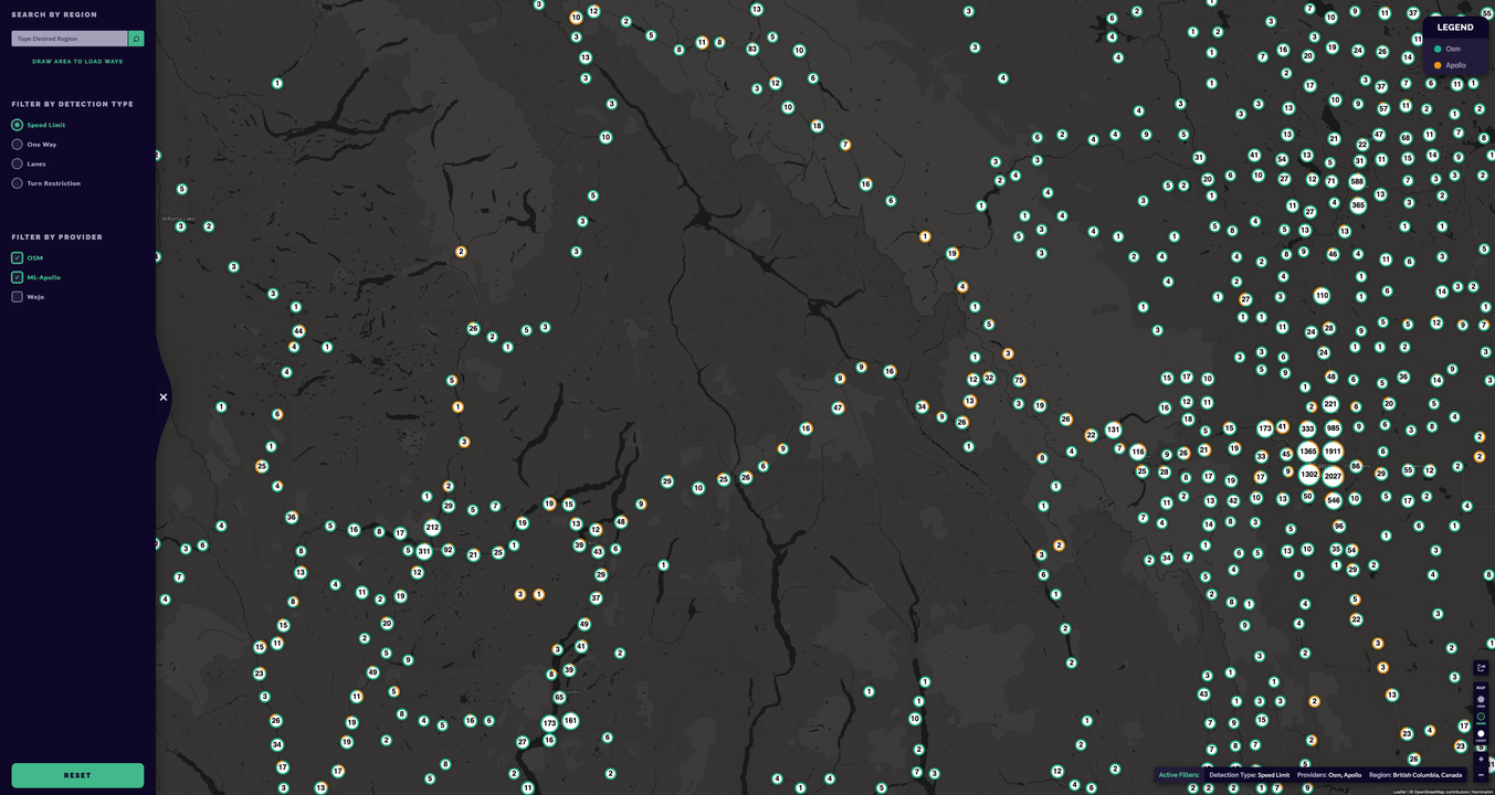
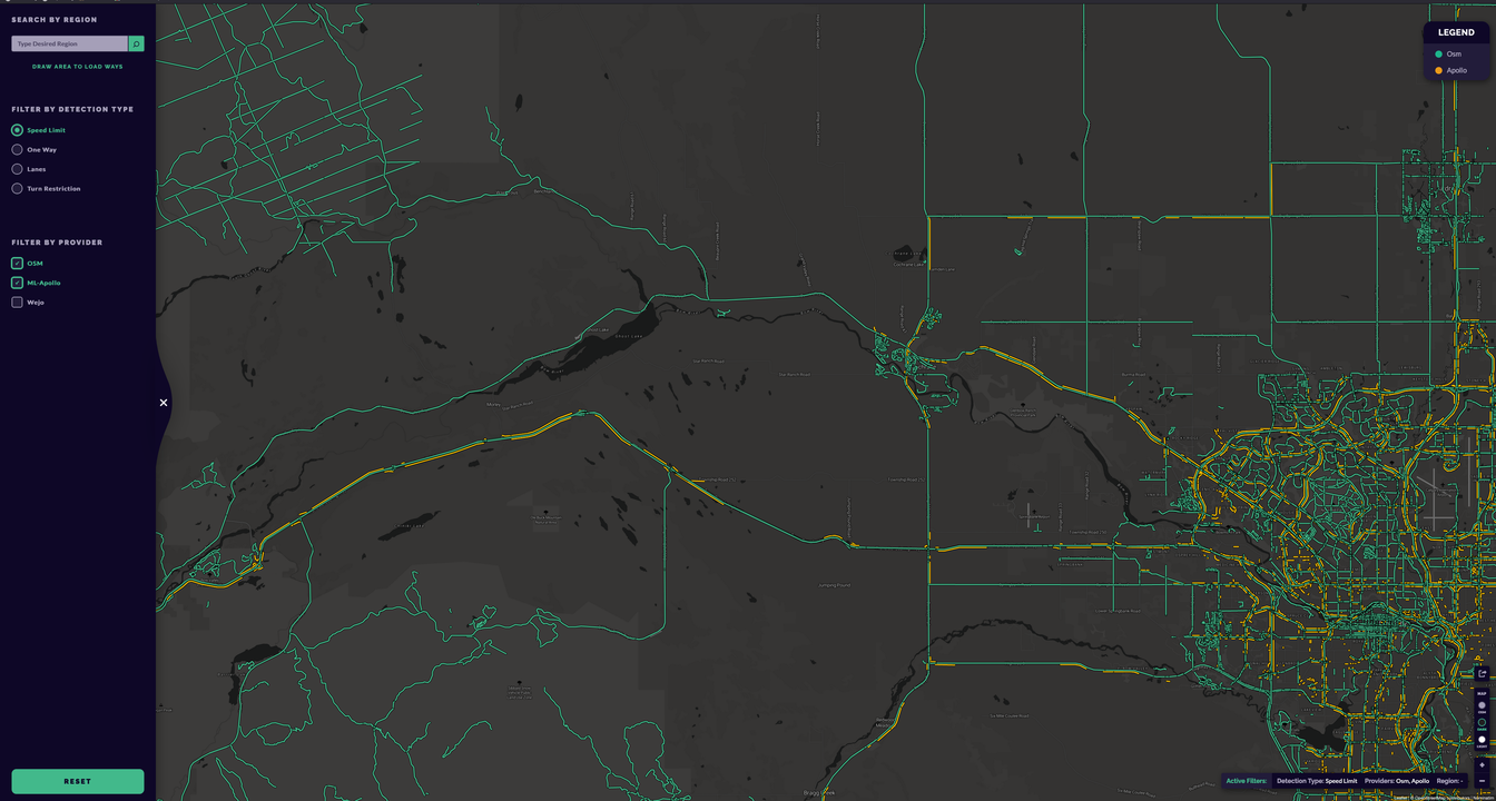
We received multiple massive datasests of geospatial routes (over 5 million routes each) that needed to be visualized on maps for analysis and insights. The GeoRoute Viewer application was developed to efficiently render and display this large-scale geospatial data, at any scale, allowing users to explore, analyze and share the routes or settings interactively. The application features advanced rendering techniques and optimizations to handle the vast amount of data while providing a smooth user experience. Golang gRpc services were used for data processing and retrieval to ensure high performance and scalability. PostgreSQL with PostGIS extension was used for efficient storage and querying of geospatial data, along with spatial indexing and partitioning strategies to optimize performance.
Key Features
- High-Performance Rendering: Utilizes advanced algorithms and technologies to retrieve and render large datasets quickly and efficiently.
- Intuitive User Interface: A user-friendly frontend that allows users to easily navigate and interact with complex geospatial data.
- Scalable Backend: Built on a robust backend architecture that can handle increasing amounts of data without compromising performance.
- Data Filtering and Search: Advanced filtering and search capabilities to help users find specific routes or data points within the massive dataset.
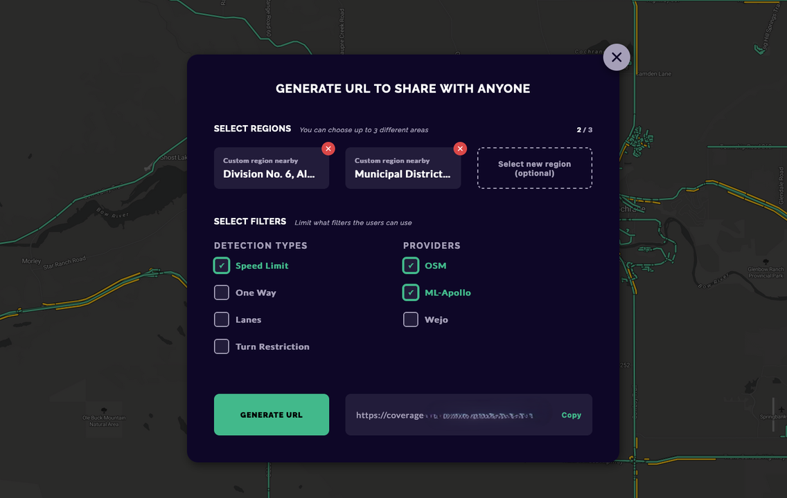
- Customizable Visualizations and sharing: Offers various visualization options, including route overlays, area limitation for privacy and more, to suit different analysis needs.
Technologies Used
Challenges & Solutions
Optimizing data retrieval and rendering processes to handle over 5 million routes without performance degradation. Implementing efficient data storage solutions to manage the large volume of geospatial data. Ensuring a seamless user experience despite the complexity and size of the dataset.
Interested in working together?
Let's discuss your next project and how I can help bring it to life.